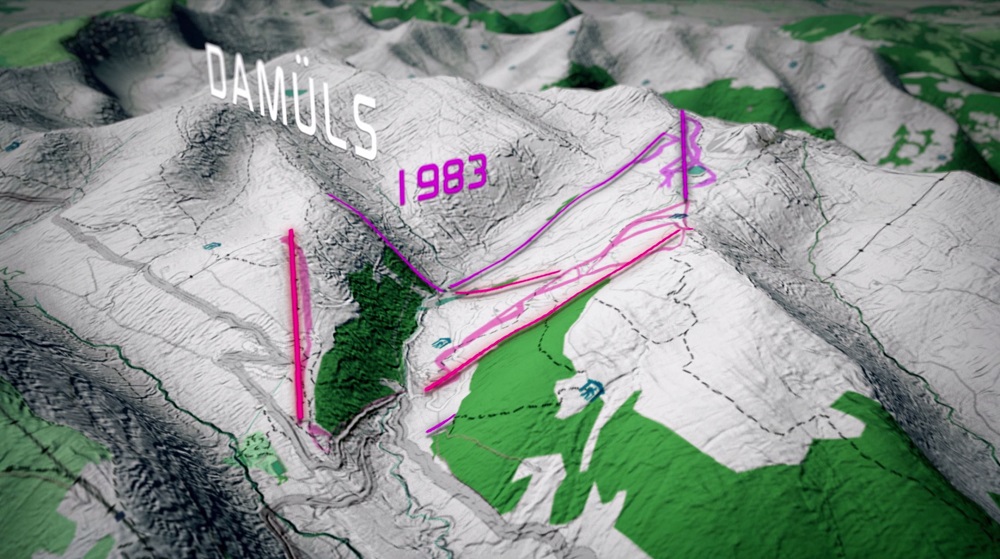
Visualization of GIS-Data
Technological advances (GPS, computing power) allow a wide-spread use of geo-information systems (GIS). The herby produced data open a huge opportunity for visualization where classic film reaches its limit. For example if historic information or changes over time need to be visualized.
This animation shows the dramatic changes in the ski region of Damüls, which occured since the skiing boom took off in the 1970ies. And it also whos the momentous consequences of the boom: tourist can reach the are only via private transport which is channeled through the narrow valleys.